Reading a map requires more than just recognizing symbols. It requires translating small lines and shaded areas on paper into real distances and directions. Scale factor activities for map reading skills give students a hands-on way to bridge that gap. When learners measure a route with a ruler, apply the map ratio, and calculate actual miles, they stop guessing and start navigating with confidence. This type of practice builds spatial reasoning and prepares them for geography lessons, hiking trips, and everyday wayfinding.
What does a scale factor actually mean on a printed map?
A scale factor is simply the ratio that compares a distance on a map to the corresponding distance in the real world. Cartographers shrink real landscapes to fit on a page using a consistent multiplier. A 1:50,000 ratio means one centimeter on the paper equals 50,000 centimeters outdoors. Students encounter different representations like verbal scales, representative fractions, and bar graphs. Graphic scales remain especially useful because they stretch or shrink with the printed page, keeping calculations accurate. When learners practice converting these ratios into actual distances, they begin to understand proportional relationships in a tangible way.
Before jumping into cartography exercises, it helps to review how shapes change when multiplied by a constant. A quick look at how dilation affects drawn figures shows why every inch on a map expands uniformly in the real world. That geometric foundation makes it much easier to grasp why a city drawn at half size still maintains accurate street proportions.
When should students start practicing these map calculations?
Map reading practice fits best right after learners grasp basic ratios and fractions. Middle school geography classes often introduce the concept, but younger students can explore it through simple floor plans or playground layouts. Anytime a group plans a field trip, studies local watersheds, or builds a neighborhood model, they can apply a scale factor to measure distances accurately. The exercises work well during outdoor education units, math lab rotations, or independent project weeks.
If you need ready-to-use templates for the classroom, structured map practice materials can guide students from basic ruler measurements to multi-step routing problems. Having a clear progression prevents confusion when switching between different map types.
Which exercises actually build confidence with proportional distances?
Start with straightforward tasks that remove guesswork. Give students a simple hiking trail map with a clear bar scale. Ask them to measure the straight-line distance between two landmarks, then multiply by the ratio to find real-world miles. Next, add curved paths where they must use string to follow the route before measuring. Gradually introduce problems that require working backward, such as planning a walk exactly two miles long on paper. Coordinate grids also help students track movement. Plotting scaled movements on a grid system reinforces how x and y values change proportionally.
A reliable routine looks like this: measure in centimeters, convert to the map ratio, multiply by the unit length, then record the result in miles or kilometers. Repeating this sequence three or four times cements the steps.
What mistakes usually cause wrong answers on scaled maps?
The most frequent error comes from mixing units. A student might measure four inches on paper but forget that the scale uses miles, leading to an answer that feels completely off. Another common issue involves ignoring the map legend. If the scale bar is labeled in kilometers but the worksheet asks for meters, a quick unit conversion is required. Some learners also measure diagonally when a road clearly curves, which shortens the actual distance. Lastly, printing maps at non-standard sizes can ruin the scale factor if the bar scale does not resize with the image. Always check that the graphic scale matches the printed margins.
How can educators verify that students truly understand the ratio?
Quick checks work better than long tests. Ask learners to explain their calculation steps out loud. If they can describe why they multiplied rather than added, they grasp the proportional concept. Provide two maps of the same area with different ratios and ask them to predict which one shows more detail. Larger scales zoom into smaller areas, so students who recognize this pattern understand how scale factors dictate map purpose. You can also have them design a small floor plan using a 1:20 ratio, then swap drawings to measure furniture placements. Real creation forces accurate application.
For official standards and cartographic guidelines, the U.S. Geological Survey mapping resources publish clear references on map scales and distance calculations that align with classroom exercises.
What should students do next to improve their navigation accuracy?
Move from paper to the field once classroom practice feels steady. Take a topographic map and a compass to a local park. Mark a starting point, calculate the distance to a visible landmark, and walk the route. Compare the estimated steps with the measured map distance. Track discrepancies and adjust pacing. Over time, learners develop an intuitive sense of how scaled measurements translate into physical movement. They will also start noticing how terrain, elevation, and obstacles affect real travel time versus straight-line calculations.
Quick checklist for your next map reading session
- Print the map at 100 percent scale to keep the bar graph accurate.
- Identify whether the scale is verbal, fractional, or graphic before measuring.
- Use a flexible string for curved roads and mark endpoints clearly with a marker.
- Convert ruler measurements to the correct real-world unit before finishing the problem.
- Double-check calculations by working backward from the real distance to the expected paper length.
- Take the map outside, walk the calculated route, and compare results with actual steps.
 Understanding Scale Factor for Perimeter and Area
 Mastering Similar Triangles with Scale Factor Problems
 Understanding the Scale Factor in Coordinate Geometry
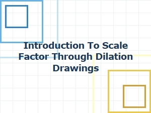 Understanding Scale Factor in Dilation Drawings
 Designing a Model City with Scale Factors
 Applying Scale Factor Concepts in Engineering Design